Sept. 16
DAY 50 Continued
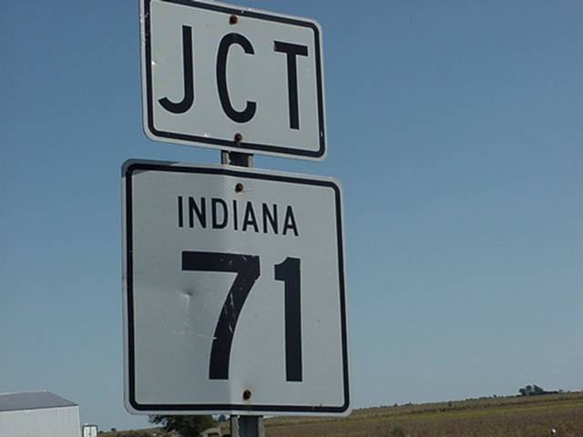
From the border it is 5 miles to
Kentland at 71 miles - all services
Goodland at 79 miles - store and cafe
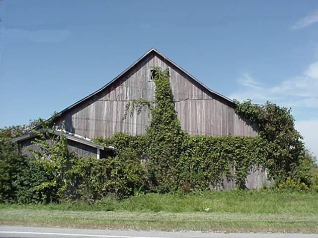
It is then another 7 miles to Remington which has all service 2 miles to the east at I-65 . Indiana looks alot like Illinois with the exception of they must be in a poor financial state,see photos below.
Sept.17
DAY 51
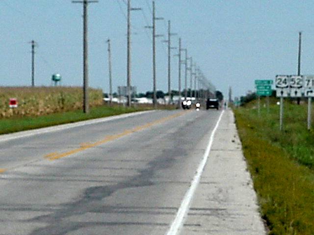
Remington to Logansport 46 miles passing the towns of
Wolcott at 5 miles_ store cafe
Reynolds at 15 miles - store,cafe,and a motel 1 mile east of town
Monticello at 20 miles -all services, motel on west side of town
Idaville at 27 miles -store
Burnettsville at 30 miles -store, cafe
Lake Cicott at 33 miles - cafe and a campground(looked closed), campground 1 mile east
Today the road started out flat to a slight grade up and down. I can not seem to get going this morning for some reason. When I get to Monticello I am tired,and my legs are stiff. I decide to make it a short day and stop at Logansport, good choice, at Burnettsville I start to feel ill. Not really sick but just do not feel good. After Lake Cicott there are some very small rolling hills and I have trouble getting up them. At Logansport I take business 24 into town and every thing is on the east side, guess I should have taken the by-pass, but there was a ramp up to it.Indiana is a screwed up place. Time zone line is just east of Remington but when I get to Logansport all the clocks are still on Central Time. Why is this? Indiana does not use day light savings time, guess they cann't remember to set their clocks ahead and back.P.S. It is 8 miles of rolling hills into Logansport from the east side and nothing there.So if stopping there best to use western business 24.
Sept. 18
DAY 52
Logansport to Decatur 83 miles passing through the towns of
Peru at 14 miles - store and cafe
Wabash at 28 miles - stores ,cafes, and motel
Huntington at46 miles - stores,cafe, and motel (west side)
Markel at 60 miles - I- 65 enterchange motels and fast food, small motel east side of town 1/2 mile
there are 3 or 4 small towns with nothing till Decatur,most stuff north 27 1/4 mile.
Felt better today and good thing the first 40 miles are small rolling hills to long slight upgrades.About 3 miles from Huntington it get flat and stays that way to Decatur.Huntington is a little screwy to get through,signs are well hidden if they are there at all.Where 24 turns to Fort Wayne you go straight into town, some where is a turn for 5 south to 224 east.Going straight through you come to a small sign that says 24 to the left stay on that road to the 4 way stop signs and go right, there is a small park and lake here with camping. Follow that road about 2 miles to another 4 way stop light and that is 224. there is a state park with camping about a mile east.Today was not real bad with the exception of once getting to the flat someone turned on the fans. 15 to 20 MPH head wind for the last 25 miles, so check todays photos and then on to
OHIO